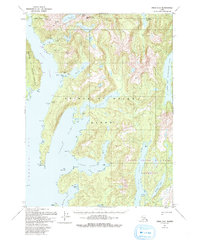
1951 Map of Craig A-2
USGS Topo · Published 1993About this map
Prince of Wales Island's mineral-rich landscape is documented here through a series of mid-century surveys and late-century updates, revealing the remnants of early 1900s copper extraction. The settlement of Hetta sits at the head of Hetta Inlet, serving as a focal point for the surrounding geography, which is dominated by the steep rises of Copper Mtn and the Jumbo Basin. The map captures the industrial footprint of the region, noting the Jumbo Mine and the sites of Coppermount and Copper City, both marked as abandoned by the time of the 1993 edition. The intricate coastline is defined by deep fjords like Kassa Inlet and Nutkwa Inlet, while the eastern portion of the sheet is largely preserved within the South Prince of Wales Wilderness, illustrating the contrast between historical industrial sites and protected Alaskan terrain.
Find a feature on this map
45 named features on this map. Tap any name to fly to it.
Don’t see what you’re looking for? This feature index may not catch every label — zoom into the map to look around manually.
Map Details
Editions of this 1951 Craig A-2 Map
3 editions found

Other maps of this area

1948 · Dixon Entrance D-2
USGS Topo · 1:63,360

1948 · Craig A-1
USGS Topo · 1:63,360

1948 · Dixon Entrance D-1
USGS Topo · 1:63,360

1948 · Dixon Entrance D-3
USGS Topo · 1:63,360

1948 · Craig A-3
USGS Topo · 1:63,360

1948 · Craig A-2
USGS Topo · 1:63,360

1949 · Craig B-2
USGS Topo · 1:63,360

1949 · Craig B-3
USGS Topo · 1:63,360

1949 · Craig B-1
USGS Topo · 1:63,360

1950 · Craig B-1
USGS Topo · 1:63,360