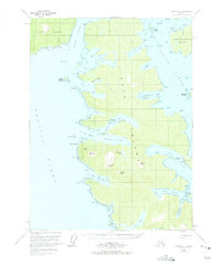
1951 Map of Craig A-4
USGS Topo · Published 1975About this map
Dall Island and Suemez Island dominate this coastal survey, defined by a labyrinth of fjords and narrow inlets within the Tongass National Forest. The 1951 field data highlights a concentrated area of industrial activity at View Cove, where a Limestone Quarry and associated Tanks are serviced by a Seaplane Base, illustrating the reliance on air and sea transport in this roadless maritime environment. These water-bound reaches, including the deep Manhattan Arm and Hook Arm, reveal a landscape where naming conventions like Cape Lookout and Hole-in-the-Wall reflect the navigational hazards and landmarks of the Tlevak Strait. The interior is marked by significant peaks such as Thunder Mtn and Bear Mtn, which rise sharply above the forested shoreline.
Find a feature on this map
65 named features on this map. Tap any name to fly to it.
Don’t see what you’re looking for? This feature index may not catch every label — zoom into the map to look around manually.
Map Details
Editions of this 1951 Craig A-4 Map
2 editions found

Other maps of this area

1948 · Craig A-4
USGS Topo · 1:63,360

1948 · Dixon Entrance D-5
USGS Topo · 1:63,360

1948 · Craig B-5
USGS Topo · 1:63,360

1948 · Craig A-5
USGS Topo · 1:63,360

1948 · Dixon Entrance D-4
USGS Topo · 1:63,360

1948 · Dixon Entrance D-3
USGS Topo · 1:63,360

1948 · Craig A-3
USGS Topo · 1:63,360

1949 · Craig B-3
USGS Topo · 1:63,360

1949 · Craig B-4
USGS Topo · 1:63,360

1951 · Craig B-4
USGS Topo · 1:63,360