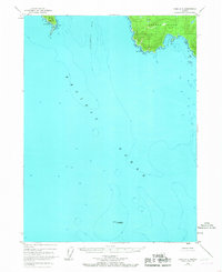
1948 Map of Craig A-5
USGS Topo · Published 1967About this map
Suemez Island and Baker Island anchor the northern reaches of this coastal survey, where the Alexander Archipelago meets the open Pacific Ocean. Compiled from 1948 aerial photography with minor revisions through the mid-1960s, the map details a complex maritime landscape of deep inlets and exposed headlands within the Tongass National Forest. The topography is defined by the steep rises of Cape Felix and the prominent protrusion of Cape Bartolome, which guards the entrance to Bucareli Bay.
Find a feature on this map
11 named features on this map. Tap any name to fly to it.
Don’t see what you’re looking for? This feature index may not catch every label — zoom into the map to look around manually.
Map Details
Editions of this 1948 Craig A-5 Map
3 editions found
Other maps of this area

1948 · Craig A-4
USGS Topo · 1:63,360

1948 · Dixon Entrance D-5
USGS Topo · 1:63,360

1948 · Craig B-5
USGS Topo · 1:63,360

1948 · Craig A-5
USGS Topo · 1:63,360

1948 · Craig B-6
USGS Topo · 1:63,360

1948 · Dixon Entrance D-4
USGS Topo · 1:63,360

1949 · Craig B-4
USGS Topo · 1:63,360

1951 · Craig B-4
USGS Topo · 1:63,360

1951 · Dixon Entrance
USGS Topo · 1:250,000

1951 · Craig A-4
USGS Topo · 1:63,360