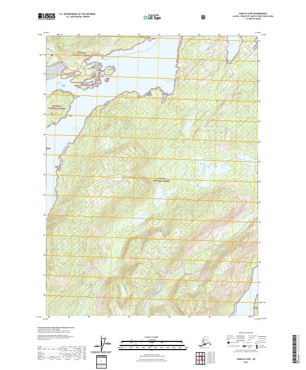
2021 Map of Craig B-2 NW
USGS Topo · Published 2021About this map
Tongass National Forest dominates this coastal Alaska landscape, where the intricate shoreline of Prince of Wales Island is defined by deep inlets and sheltered waters. Hollis Anchorage and Clark Bay provide protected maritime access at the northern edge, while the long reach of Twelvemile Arm extends along the western coast. The interior is a complex network of drainage systems, including Kina Cr and Old Franks Cr, which feed significant water bodies like Kina Lake and Old Franks Lake. Local transit is limited to a handful of forest corridors such as Maybeso Road and Peninsula Road. Prominent coastal landmarks like Althouse Point and Kajusgidas Point serve as key navigational markers for the surrounding Twelvemile Bay and Kina Cove.
Find a feature on this map
29 named features on this map. Tap any name to fly to it.
Don’t see what you’re looking for? This feature index may not catch every label — zoom into the map to look around manually.
Map Details
Editions of this 2021 Craig B-2 NW Map
This is the sole edition of this map. No revisions or reprints were ever made.
Other maps of this area

1949 · Craig C-2
USGS Topo · 1:63,360

1949 · Craig B-2
USGS Topo · 1:63,360

1949 · Craig B-3
USGS Topo · 1:63,360

1949 · Craig C-3
USGS Topo · 1:63,360

1951 · Craig C-3
USGS Topo · 1:63,360

1951 · Craig B-2
USGS Topo · 1:63,360

1951 · Craig C-2
USGS Topo · 1:63,360

1951 · Craig B-3
USGS Topo · 1:63,360

1957 · Craig
USGS Topo · 1:250,000
1994 · Craig C-2
USGS Topo · 1:63,360