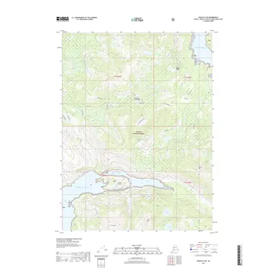
2017 Map of Craig B-2 SW
USGS Topo · Published 2017About this map
Polk Inlet and the complex waterways of the Alexander Archipelago dominate this coastal survey on Prince of Wales Island. The terrain is defined by dramatic elevation changes, rising from the Pacific Ocean at Kina Cove to the high peaks of Beaver Mtn, Billie Mtn, and Mt Jumbo. The maritime geography is particularly intricate near Portage Bay, where Sulzer Passage and Gould Passage navigate around Gould Island.
Find a feature on this map
39 named features on this map. Tap any name to fly to it.
Don’t see what you’re looking for? This feature index may not catch every label — zoom into the map to look around manually.
Map Details
Editions of this 2017 Craig B-2 SW Map
This is the sole edition of this map. No revisions or reprints were ever made.
Other maps of this area

1948 · Craig A-3
USGS Topo · 1:63,360

1948 · Craig A-2
USGS Topo · 1:63,360

1949 · Craig B-2
USGS Topo · 1:63,360

1949 · Craig B-3
USGS Topo · 1:63,360

1951 · Craig B-2
USGS Topo · 1:63,360

1951 · Craig B-3
USGS Topo · 1:63,360

1951 · Craig A-2
USGS Topo · 1:63,360

1951 · Craig A-3
USGS Topo · 1:63,360

1957 · Craig
USGS Topo · 1:250,000
1996 · Craig A-2
USGS Topo · 1:63,360