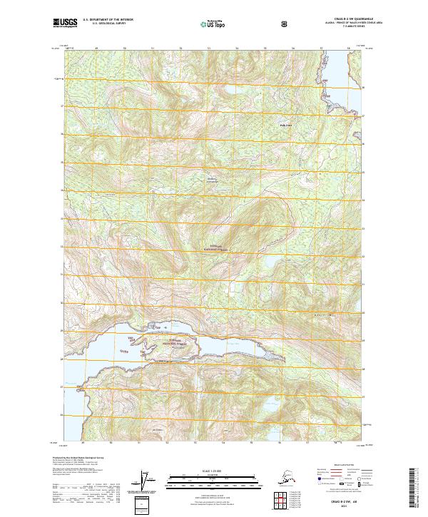
2021 Map of Craig B-2 SW
USGS Topo · Published 2021About this map
Polk Inlet and Hetta Inlet define the maritime character of this corner of the Alexander Archipelago within the Tongass National Forest. The landscape is dominated by high ridges and peaks such as Beaver Mtn and Mt Jumbo, which overlook complex waterways like Sulzer Passage and Portage Bay. The map documents a network of forest roads and spurs, including the Summit Spur and North Spur, reflecting modern timber and resource management in the region. Notable industrial and logistical points are identified by labels such as Log Dump and Dog Salmon, while several inland bodies of water, including Lake Isabel and Lake Gertrude, are tucked into the steep drainages. This recent survey captures the intricate shoreline of islands like Gould Island and Dell Island before they meet the open waters of the Prince of Wales-Hyder area.
Find a feature on this map
35 named features on this map. Tap any name to fly to it.
Don’t see what you’re looking for? This feature index may not catch every label — zoom into the map to look around manually.
Map Details
Editions of this 2021 Craig B-2 SW Map
This is the sole edition of this map. No revisions or reprints were ever made.
Other maps of this area

1948 · Craig A-3
USGS Topo · 1:63,360

1948 · Craig A-2
USGS Topo · 1:63,360

1949 · Craig B-2
USGS Topo · 1:63,360

1949 · Craig B-3
USGS Topo · 1:63,360

1951 · Craig B-2
USGS Topo · 1:63,360

1951 · Craig B-3
USGS Topo · 1:63,360

1951 · Craig A-2
USGS Topo · 1:63,360

1951 · Craig A-3
USGS Topo · 1:63,360

1957 · Craig
USGS Topo · 1:250,000
1996 · Craig A-2
USGS Topo · 1:63,360