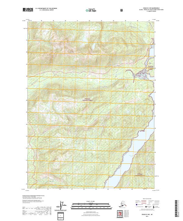
2021 Map of Craig B-3 NE
USGS Topo · Published 2021About this map
Harris Peak stands as a prominent landmark in this portion of the Tongass National Forest, overlooking a landscape defined by the drainage systems of the Harris River and Maybeso Cr. The presence of the High Dawson Mine near the northern boundary indicates the area's history of mineral extraction within the Prince of Wales-Hyder region. The coastline is marked by the sheltered waters of Twelvemile Arm and the distinctive Cat Island, providing a clear view of the maritime interface of the Alaskan panhandle.
Find a feature on this map
27 named features on this map. Tap any name to fly to it.
Don’t see what you’re looking for? This feature index may not catch every label — zoom into the map to look around manually.
Map Details
Editions of this 2021 Craig B-3 NE Map
This is the sole edition of this map. No revisions or reprints were ever made.
Other maps of this area

1949 · Craig C-2
USGS Topo · 1:63,360

1949 · Craig B-2
USGS Topo · 1:63,360

1949 · Craig B-3
USGS Topo · 1:63,360

1949 · Craig C-3
USGS Topo · 1:63,360

1951 · Craig C-3
USGS Topo · 1:63,360

1951 · Craig B-2
USGS Topo · 1:63,360

1951 · Craig C-2
USGS Topo · 1:63,360

1951 · Craig B-3
USGS Topo · 1:63,360

1957 · Craig
USGS Topo · 1:250,000
1994 · Craig C-2
USGS Topo · 1:63,360