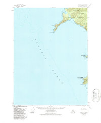
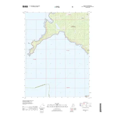
1948 Map of Craig B-6
USGS Topo · Published 1987About this map
Noyes Island and Baker Island dominate this coastal survey of Southeast Alaska, capturing the maritime geography of the Alexander Archipelago shortly after World War II. The map highlights the significant protrusion of Cape Addington into the Pacific Ocean, a prominent landmark for navigation near the Tongass National Forest boundary. This 1948 topographic study reveals the isolation of the western shoreline, where features like Shaft Rk and Dizzy define the hazardous transition from open sea to rocky coast. The presence of a substantial Tidal Flat on the southern side of Noyes Island indicates the dynamic intertidal environment of the region's fjords and bays. This data, later revised in the 1970s and 80s, remains a primary record for those tracing the historical hydrography and shoreline character of Baker Island and the surrounding outer coast before modern development.
Find a feature on this map
14 named features on this map. Tap any name to fly to it.
Don’t see what you’re looking for? This feature index may not catch every label — zoom into the map to look around manually.
Map Details
Editions of this 1948 Craig B-6 Map
3 editions found
Other maps of this area

1948 · Craig B-5
USGS Topo · 1:63,360

1948 · Craig A-5
USGS Topo · 1:63,360

1948 · Craig B-6
USGS Topo · 1:63,360

1951 · Craig C-6
USGS Topo · 1:63,360

1951 · Craig C-5
USGS Topo · 1:63,360

1957 · Craig
USGS Topo · 1:250,000
2000 · Craig B-6
USGS Topo · 1:63,360

2000 · Craig B-5
USGS Topo · 1:63,360
2017 · Craig B-6 SE
USGS Topo · 1:25,000
2017 · Craig B-6 NE
USGS Topo · 1:25,000