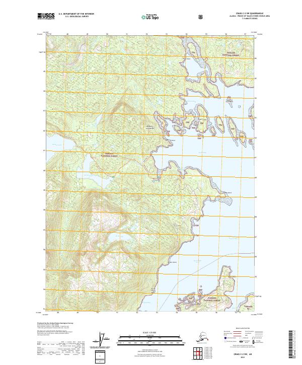
2021 Map of Craig C-2 SW
USGS Topo · Published 2021About this map
Tongass National Forest dominates this section of the Alexander Archipelago, where the maritime landscape of Prince of Wales Island is defined by a complex network of bays and freshwater systems. The drainage of Goose Cr and Paul Young Cr feeds into the coastal waters of Browns Bay, while the inland geography is anchored by substantial water bodies like Wolf Lake, Salmon Lake, and Karta Lake. The presence of the Karta River Trl and Karta Bay Trl suggests established routes through the timbered terrain, connecting the interior watersheds to the shoreline at Karta Bay. Along the coast, numerous named landmarks such as Alder Point, Mound Point, and Forty Pound Point mark the transition into the deep reaches of Twelvemile Arm and Kasaan Bay. Small islands, including Fourth of July Island and Gosti Island, dot the eastern waters.
Find a feature on this map
34 named features on this map. Tap any name to fly to it.
Don’t see what you’re looking for? This feature index may not catch every label — zoom into the map to look around manually.
Map Details
Editions of this 2021 Craig C-2 SW Map
This is the sole edition of this map. No revisions or reprints were ever made.
Other maps of this area

1949 · Craig C-2
USGS Topo · 1:63,360

1949 · Craig B-2
USGS Topo · 1:63,360

1949 · Craig B-3
USGS Topo · 1:63,360

1949 · Craig C-3
USGS Topo · 1:63,360

1951 · Craig C-3
USGS Topo · 1:63,360

1951 · Craig B-2
USGS Topo · 1:63,360

1951 · Craig C-2
USGS Topo · 1:63,360

1951 · Craig B-3
USGS Topo · 1:63,360

1957 · Craig
USGS Topo · 1:250,000
1994 · Craig C-2
USGS Topo · 1:63,360