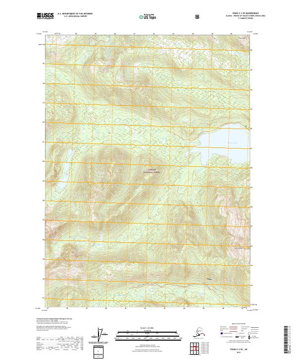
2021 Map of Craig C-3 SE
USGS Topo · Published 2021About this map
The settlement of Hollis serves as the focal point for this section of Tongass National Forest on Prince of Wales Island. The landscape is defined by the high elevations of Granite Mtn and Rush Peak, which give way to a network of drainage systems including Maybeso Cr and McGilvery Cr. Near the eastern edge, Salmon Lake provides a significant water feature, connected to the surrounding wilderness by the Karta River Trl. The local infrastructure reflects the area's history of forest access and resource management, anchored by Maybeso Road and the Maybeso Road Trl that follow the valley floor. Researchers can trace the path of Flagstaff Cr as it descends from the southern peaks toward the coastal lowlands, illustrating the island's steep and complex hydrology.
Find a feature on this map
17 named features on this map. Tap any name to fly to it.
Don’t see what you’re looking for? This feature index may not catch every label — zoom into the map to look around manually.
Map Details
Editions of this 2021 Craig C-3 SE Map
This is the sole edition of this map. No revisions or reprints were ever made.
Other maps of this area

1949 · Craig C-2
USGS Topo · 1:63,360

1949 · Craig B-2
USGS Topo · 1:63,360

1949 · Craig B-3
USGS Topo · 1:63,360

1949 · Craig C-3
USGS Topo · 1:63,360

1951 · Craig C-3
USGS Topo · 1:63,360

1951 · Craig B-2
USGS Topo · 1:63,360

1951 · Craig C-2
USGS Topo · 1:63,360

1951 · Craig B-3
USGS Topo · 1:63,360

1957 · Craig
USGS Topo · 1:250,000
1994 · Craig C-2
USGS Topo · 1:63,360