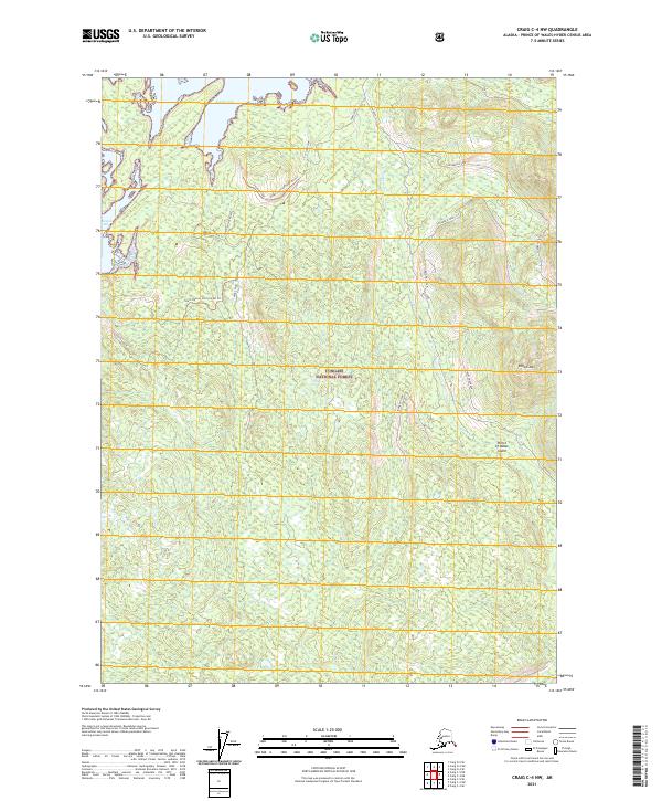
2021 Map of Craig C-4 NW
USGS Topo · Published 2021About this map
Prince of Wales Island is documented here as part of the Tongass National Forest in Southeast Alaska. The landscape is characterized by its complex shoreline, specifically where Nossuk Bay and Kaguk Cove meet the timbered interior. The drainage of Shaheen Cr flows through the eastern portion of the quadrangle, flanked by the prominent Kogish Mtn. The infrastructure of this era is defined by a network of specialized routes, including the Kaguk Cove 2051045 Rd Trl and various spurs such as Shaheen Spur and Front Spur. These designations suggest a history of resource management and access through the dense coastal forest, providing a clear record of the access points to the water and high ground at Winter Harbor.
Find a feature on this map
25 named features on this map. Tap any name to fly to it.
Don’t see what you’re looking for? This feature index may not catch every label — zoom into the map to look around manually.
Map Details
Editions of this 2021 Craig C-4 NW Map
This is the sole edition of this map. No revisions or reprints were ever made.
Other maps of this area

1949 · Craig D-4
USGS Topo · 1:63,360

1949 · Craig C-4
USGS Topo · 1:63,360

1951 · Craig C-4
USGS Topo · 1:63,360

1951 · Craig C-5
USGS Topo · 1:63,360

1951 · Craig D-5
USGS Topo · 1:63,360

1951 · Craig D-4
USGS Topo · 1:63,360

1957 · Craig
USGS Topo · 1:250,000
1994 · Craig D-4
USGS Topo · 1:63,360
1996 · Craig D-5
USGS Topo · 1:63,360
2017 · Craig D-4 SE
USGS Topo · 1:25,000