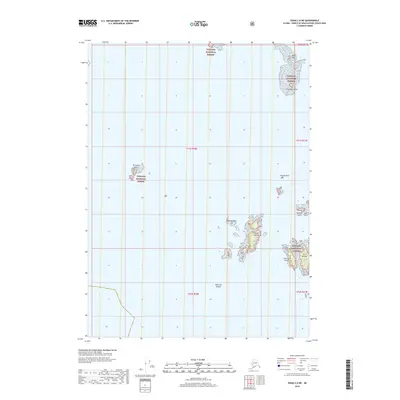
2018 Map of Craig C-6 NE
USGS Topo · Published 2018About this map
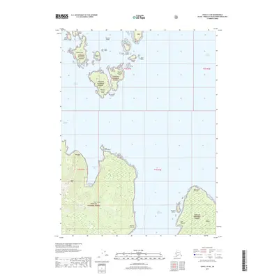
The scattered archipelagos of the Alexander Archipelago are charted in this 2018 survey by the U.S. Geological Survey, focusing on the maritime boundaries within the Tongass National Forest. The map is dominated by the intricate shorelines of the Wood Islands and the Maurelle Islands, which emerge from the waters of the Prince of Wales-Hyder Census Area. Smaller isolated landmasses such as Emerald Island to the north and Timbered Island to the west serve as critical navigational markers in this island-rich environment. This cartographic study illustrates the complex physical geography of Southeast Alaska, where individual landmarks like Epsilon Rock, Feather Rock, and the Twin Islands define the nautical landscape. The absence of roads or settlements emphasizes the protected, wilderness character of these coastal reaches, managed by the U.S. Department of the Interior.
Find a feature on this map
15 named features on this map. Tap any name to fly to it.
Don’t see what you’re looking for? This feature index may not catch every label — zoom into the map to look around manually.
Map Details
Editions of this 2018 Craig C-6 NE Map
This is the sole edition of this map. No revisions or reprints were ever made.
Other maps of this area

1951 · Craig C-6
USGS Topo · 1:63,360

1951 · Craig D-6
USGS Topo · 1:63,360

1951 · Craig C-5
USGS Topo · 1:63,360

1951 · Craig D-5
USGS Topo · 1:63,360

1957 · Craig
USGS Topo · 1:250,000
1996 · Craig D-5
USGS Topo · 1:63,360
2017 · Craig C-5 NW
USGS Topo · 1:25,000
2017 · Craig D-6 SW
USGS Topo · 1:25,000
2017 · Craig C-5 SW
USGS Topo · 1:25,000
2017 · Craig D-5 SW
USGS Topo · 1:25,000