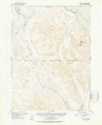
1950 Map of Craig D-3
USGS Topo · Published 1953About this map
Prince of Wales Island is documented here during the early 1950s, a period captured through 1948 aerial photography and 1950 topographic fieldwork. The landscape is defined by its extensive water systems, including the large Sweetwater Lake in the northwest and the winding course of the Thorne River which flows into Thorne Lake to the south. Coastal features along the Clarence Strait show the natural indentations of Coffman Cove and Luck Pt. Elevations rise significantly at Baird Pk, reaching over 3,000 feet, providing a clear picture of the high-relief terrain that characterizes the Tongass National Forest. This survey provides researchers with a baseline of the island's wilderness and coastal contours before more modern development or intensive logging road networks expanded across this portion of the archipelago.
Find a feature on this map
15 named features on this map. Tap any name to fly to it.
Don’t see what you’re looking for? This feature index may not catch every label — zoom into the map to look around manually.
Map Details
Editions of this 1950 Craig D-3 Map
2 editions found
Other maps of this area

1948 · Petersburg A-2
USGS Topo · 1:63,360

1949 · Craig D-3
USGS Topo · 1:63,360

1949 · Craig C-2
USGS Topo · 1:63,360

1949 · Craig D-2
USGS Topo · 1:63,360

1949 · Petersburg A-3
USGS Topo · 1:63,360

1949 · Craig D-4
USGS Topo · 1:63,360

1949 · Petersburg A-4
USGS Topo · 1:63,360

1949 · Craig C-3
USGS Topo · 1:63,360

1949 · Craig C-4
USGS Topo · 1:63,360

1950 · Craig D-3
USGS Topo · 1:63,360