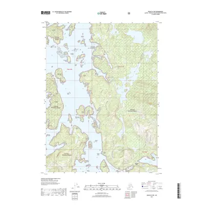
2017 Map of Craig D-4 NW
USGS Topo · Published 2017About this map
Sarkar Lake and its intricate drainage system dominate this portion of the Tongass National Forest on Prince of Wales Island. The landscape is defined by a dense network of forest service roads and established portage paths, most notably the Sarkar Canoe Route and the Deweyville Trail, which provide passage between the interior freshwater lakes and the tidal reaches of Sarkar Cove. To the south, the waters of Naukati Bay and Tuxekan Narrows frame a rugged coastline of points and islands, including Graveyard Island and El Capitan Island. The map documents a modern working forest where timber access roads like the Long Lake 2060100 Rd intersect with traditional maritime landmarks. High points such as Pin Peak and Sarkar Hill provide vertical relief in a territory where the boundary between land and water is constantly blurred by an archipelago of features like the Kassan Islands and Sigh Islands.
Find a feature on this map
59 named features on this map. Tap any name to fly to it.
Don’t see what you’re looking for? This feature index may not catch every label — zoom into the map to look around manually.
Map Details
Editions of this 2017 Craig D-4 NW Map
This is the sole edition of this map. No revisions or reprints were ever made.
Other maps of this area

1949 · Craig D-4
USGS Topo · 1:63,360

1949 · Petersburg A-5
USGS Topo · 1:63,360

1949 · Petersburg A-4
USGS Topo · 1:63,360

1951 · Craig D-5
USGS Topo · 1:63,360

1951 · Craig D-4
USGS Topo · 1:63,360

1952 · Petersburg
USGS Topo · 1:250,000

1953 · Petersburg A-5
USGS Topo · 1:63,360

1953 · Petersburg A-4
USGS Topo · 1:63,360

1957 · Craig
USGS Topo · 1:250,000

1960 · Petersburg
USGS Topo · 1:250,000