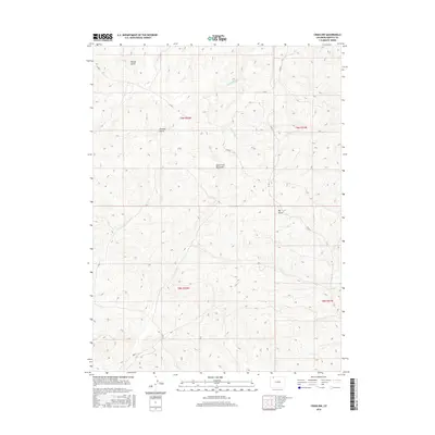
2016 Map of Craig NW
USGS Topo · Published 2016About this map
North Fork Big Gulch and Big Gulch define the drainage patterns of this high-altitude landscape in Moffat County, where the terrain is deeply etched by a network of seasonal washes and creek beds. The map illustrates a region managed by the U.S. Bureau of Land Management and private interests, marked by the systematic grid of Public Land Survey System townships such as t9n r92w and t9n r91w. Human presence is primarily indicated by a sparse network of county infrastructure, including Co RD 5 and Co RD 3, which navigate the elevation changes between Housel Gulch and Dressler Gulch. The presence of named watercourses like W Timberlake Cr and Blue Gravel Cr highlights the vital importance of water management in this arid stretch of Colorado. This 2016 survey documents the enduring rural character of the area northwest of Craig, focusing on topographical detail and remote access routes like Ubr Ln.
Find a feature on this map
14 named features on this map. Tap any name to fly to it.
Don’t see what you’re looking for? This feature index may not catch every label — zoom into the map to look around manually.
Map Details
Editions of this 2016 Craig NW Map
This is the sole edition of this map. No revisions or reprints were ever made.
Other maps of this area

1916 · Craig
USGS Topo · 1:125,000

1954 · Craig
USGS Topo · 1:250,000

1957 · Craig
USGS Topo · 1:250,000

1958 · Craig
USGS Topo · 1:250,000

1960 · Craig
USGS Topo · 1:250,000

1962 · Craig
USGS Topo · 1:250,000

1964 · Craig
USGS Topo · 1:250,000

1965 · Craig
USGS Topo · 1:250,000
1969 · Great Divide
USGS Topo · 1:24,000
1969 · Fortification
USGS Topo · 1:24,000