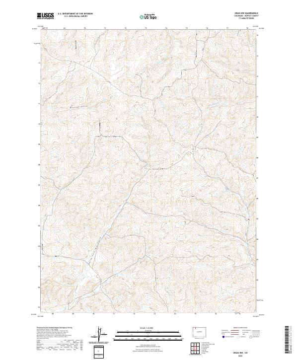
2022 Map of Craig NW
USGS Topo · Published 2022About this map
Moffat County's high desert landscape is defined by the complex drainage systems and gulches that carve through its sagebrush-covered hills. The North Fork Big Gulch and Housel Gulch are prominent features, illustrating the seasonal water movement that has shaped the topography of the t9n r92w and t9n r91w townships. These drainages, including Blue Gravel Cr and W Timberlake Cr, provide essential pathways for local runoff in an otherwise arid environment. Human presence in this northwestern Colorado region is primarily indicated by the sparse network of rural roads such as Co Rd 5 and Co Rd 3, reflecting the area's agricultural and ranching heritage. The map also documents the lesser-traveled Ubb Ln, providing a detailed view of the infrastructure supporting these remote parcels as they appeared in the early 2020s.
Find a feature on this map
12 named features on this map. Tap any name to fly to it.
Don’t see what you’re looking for? This feature index may not catch every label — zoom into the map to look around manually.
Map Details
Editions of this 2022 Craig NW Map
This is the sole edition of this map. No revisions or reprints were ever made.
Other maps of this area

1916 · Craig
USGS Topo · 1:125,000

1954 · Craig
USGS Topo · 1:250,000

1957 · Craig
USGS Topo · 1:250,000

1958 · Craig
USGS Topo · 1:250,000

1960 · Craig
USGS Topo · 1:250,000

1962 · Craig
USGS Topo · 1:250,000

1964 · Craig
USGS Topo · 1:250,000

1965 · Craig
USGS Topo · 1:250,000
1969 · Great Divide
USGS Topo · 1:24,000
1969 · Fortification
USGS Topo · 1:24,000