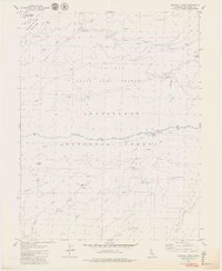
1979 Map of Crandall Peak
USGS Topo · Published 1979About this map
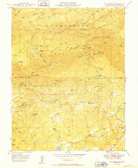
Stanislaus National Forest terrain dominates this 1970s landscape, where the Middle Fork Stanislaus River carves a deep path through the central Tuolumne County high country. The map captures an era of resource management and recreational utility, showing a network of Old Railroad Grades and Jeep Trails that traverse the ridges between peaks like Crandall Peak and Mount Knight. Near the river, the Sand Bar Flat Dam and a nearby Gaging Station indicate the vital role of water management in the Sierra foothills.
Find a feature on this map
55 named features on this map. Tap any name to fly to it.
Don’t see what you’re looking for? This feature index may not catch every label — zoom into the map to look around manually.
Map Details
Editions of this 1979 Crandall Peak Map
3 editions found
Other maps of this area

1891 · Big Trees
USGS Topo · 1:125,000

1894 · Big Trees
USGS Topo · 1:125,000

1897 · Big Trees
USGS Topo · 1:125,000

1901 · Big Trees
USGS Topo · 1:125,000

1947 · Sacramento
USGS Topo · 1:250,000

1948 · Sacramento
USGS Topo · 1:250,000

1948 · Columbia
USGS Topo · 1:62,500
1948 · Columbia SE
USGS Topo · 1:24,000

1948 · Stanislaus
USGS Topo · 1:24,000
1949 · Columbia SE
USGS Topo · 1:24,000