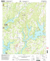
2000 Map of Crane Hill
USGS Topo · Published 2003About this map
Lewis Smith Lake dominates the landscape of Cullman County, branching into intricate fingers like Crooked Creek and Ryan Creek where the Winston Co Cullman Co line crosses the water. The settlement of Crane Hill serves as a central point for a rural network of churches and schools, including Dowling Jr High Sch and Mt Hope Ch. To the north and west, the terrain rises into the WB Bankhead Nat For, while the southern reaches of the map reveal the heavy industrial footprint of numerous Strip Mines and larger operations near Alder Branch. This document captures the tension between the recreational development of the shoreline and the persistent extractive industries of the region. Local genealogy is well-represented through family-named landmarks and rural congregations like Rushings Chapel and Wheeler Grove Ch.
Find a feature on this map
53 named features on this map. Tap any name to fly to it.
Don’t see what you’re looking for? This feature index may not catch every label — zoom into the map to look around manually.
Map Details
Editions of this 2000 Crane Hill Map
This is the sole edition of this map. No revisions or reprints were ever made.
Other maps of this area

1888 · Cullman
USGS Topo · 1:125,000

1889 · Birmingham
USGS Topo · 1:125,000

1892 · Cullman
USGS Topo · 1:125,000

1892 · Birmingham
USGS Topo · 1:125,000

1893 · Jasper
USGS Topo · 1:125,000

1895 · Birmingham
USGS Topo · 1:125,000

1907 · Birmingham
USGS Topo · 1:125,000

1949 · Cold Springs
USGS Topo · 1:24,000

1949 · Sunlight
USGS Topo · 1:24,000

1951 · Cold Springs
USGS Topo · 1:24,000