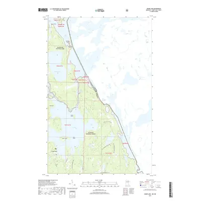
2019 Map of Crane Lake
USGS Topo · Published 2019About this map
Crane Lake serves as a central hub for this water-dominated landscape along the international border between the United States and Canada. The map illustrates a complex network of glacial lakes and narrow waterways, including Sand Point Lake and the restrictive passage at Harrison Narrows. Much of the western territory is protected as part of Voyageurs National Park, while the eastern portion falls within the Superior National Forest.
Find a feature on this map
32 named features on this map. Tap any name to fly to it.
Don’t see what you’re looking for? This feature index may not catch every label — zoom into the map to look around manually.
Map Details
Editions of this 2019 Crane Lake Map
This is the sole edition of this map. No revisions or reprints were ever made.
Other maps of this area

1954 · International Falls
USGS Topo · 1:250,000

1957 · International Falls
USGS Topo · 1:250,000

1958 · International Falls
USGS Topo · 1:250,000

1963 · Echo Lake
USGS Topo · 1:24,000

1963 · Snow Bay
USGS Topo · 1:24,000

1963 · Redhorse Bay
USGS Topo · 1:24,000

1963 · Lake Jeanette
USGS Topo · 1:24,000

1963 · Crane Lake
USGS Topo · 1:24,000

1967 · Kabustasa Lake
USGS Topo · 1:24,000

1967 · Hale Bay
USGS Topo · 1:24,000