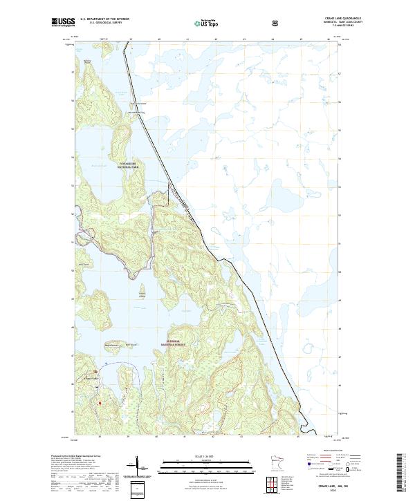
2022 Map of Crane Lake
USGS Topo · Published 2022About this map
The international border weaves through the complex waterways of this northern wilderness, where the Voyageurs National Park meets the Superior National Forest. This borderlands geography is defined by narrow passages and expansive water bodies, including Sand Point Lake and Little Vermilion Lake, which are linked by strategic channels like King Williams Narrows and Harrison Narrows. The settlement of Crane Lake serves as a primary access point at the southwestern edge, connecting local routes like Highway 74 and Nelson RD to the vast aquatic network of East Bay and the Loon River. The landscape is dotted with named islands and points such as Bear Island, Wolf Point, and Ingersolls Island, highlighting a transition from recreational settlement to protected wilderness where historical portages and modern trails like the Voyageur Snowmobile Trl crisscross the terrain.
Find a feature on this map
34 named features on this map. Tap any name to fly to it.
Don’t see what you’re looking for? This feature index may not catch every label — zoom into the map to look around manually.
Map Details
Editions of this 2022 Crane Lake Map
This is the sole edition of this map. No revisions or reprints were ever made.
Other maps of this area

1954 · International Falls
USGS Topo · 1:250,000

1957 · International Falls
USGS Topo · 1:250,000

1958 · International Falls
USGS Topo · 1:250,000

1963 · Echo Lake
USGS Topo · 1:24,000

1963 · Snow Bay
USGS Topo · 1:24,000

1963 · Redhorse Bay
USGS Topo · 1:24,000

1963 · Lake Jeanette
USGS Topo · 1:24,000

1963 · Crane Lake
USGS Topo · 1:24,000

1967 · Kabustasa Lake
USGS Topo · 1:24,000

1967 · Hale Bay
USGS Topo · 1:24,000