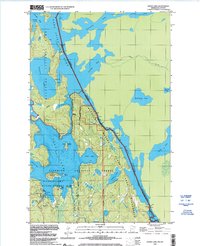
1999 Map of Crane Lake
USGS Topo · Published 2003About this map
Sand Point Lake and the interconnected waters of the Voyageurs National Park anchor this northern Minnesota landscape, where the international border with Canada threads through narrow channels and open bays. The map documents the settlement at Crane Lake, featuring the Crane Lake Chapel and a vital Port of Entry Customs facility, indicating the area's importance as a gateway for water-based travel and trade. The complex hydrography includes King Williams Narrows and the Little Vermilion Lake, illustrating a transition from the protected waters of the Superior National Forest to the Boundary Waters Canoe Area Wilderness. Numerous islands like Indian Island and Baylis Island dot the lake surfaces, while the presence of a Boat Ramp and multiple Campgrounds reflects the region's long-standing reliance on seasonal navigation and wilderness recreation.
Find a feature on this map
39 named features on this map. Tap any name to fly to it.
Don’t see what you’re looking for? This feature index may not catch every label — zoom into the map to look around manually.
Map Details
Editions of this 1999 Crane Lake Map
This is the sole edition of this map. No revisions or reprints were ever made.
Other maps of this area

1954 · International Falls
USGS Topo · 1:250,000

1957 · International Falls
USGS Topo · 1:250,000

1958 · International Falls
USGS Topo · 1:250,000

1963 · Echo Lake
USGS Topo · 1:24,000

1963 · Snow Bay
USGS Topo · 1:24,000

1963 · Redhorse Bay
USGS Topo · 1:24,000

1963 · Lake Jeanette
USGS Topo · 1:24,000

1963 · Crane Lake
USGS Topo · 1:24,000

1967 · Kabustasa Lake
USGS Topo · 1:24,000

1967 · Hale Bay
USGS Topo · 1:24,000