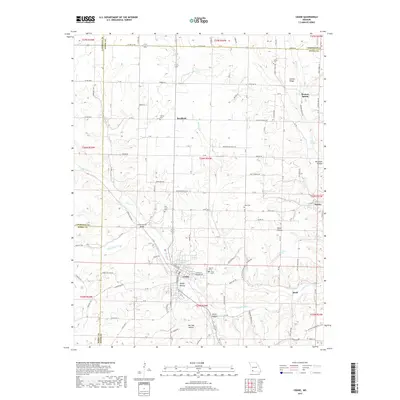
2017 Map of Crane
USGS Topo · Published 2017About this map
Crane serves as a central hub in this Ozark landscape, situated at the confluence where McCord Br meets Crane Cr. The settlement pattern reflects the area's agricultural and rural roots, with small communities like Hurley, Bradfield, and Quail connected by a network of state highways and country roads. The terrain is defined by deep incisions such as Little Crane Valley, Dodge Hollow, and Bur Oak Hollow, which dictate the placement of local homesteads and travel routes.
Find a feature on this map
73 named features on this map. Tap any name to fly to it.
Don’t see what you’re looking for? This feature index may not catch every label — zoom into the map to look around manually.
Map Details
Editions of this 2017 Crane Map
This is the sole edition of this map. No revisions or reprints were ever made.
Other maps of this area

1884 · Springfield
USGS Topo · 1:125,000

1886 · Greenfield
USGS Topo · 1:125,000

1886 · Springfield
USGS Topo · 1:125,000

1888 · Greenfield
USGS Topo · 1:125,000

1907 · Forsyth
USGS Topo · 1:125,000

1919 · Halltown
USGS Topo · 1:62,500

1942 · Aurora
USGS Topo · 1:62,500

1945 · Harrison
USGS Topo · 1:250,000

1945 · Aurora
USGS Topo · 1:62,500

1949 · Harrison
USGS Topo · 1:250,000