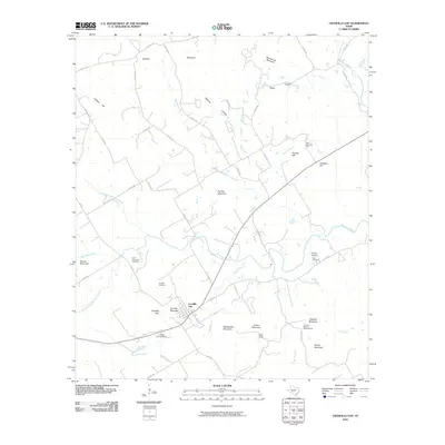
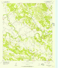
2010 Map of Cranfills Gap
USGS Topo · Published 2010About this map
Cranfills Gap serves as the focal point of this Central Texas landscape, situated at a natural break between the prominent limestone ridges of Cranfills Mountain and Rattlesnake Mountain. The settlement pattern reflects the enduring agricultural heritage of Bosque County, notably through named family holdings like the John Pederson Farm and the Tom and Martha Rogstad Farm. These labels, unusual for contemporary topographic sheets, highlight the historical significance of specific homesteads in the local community.
Find a feature on this map
50 named features on this map. Tap any name to fly to it.
Don’t see what you’re looking for? This feature index may not catch every label — zoom into the map to look around manually.
Map Details
Editions of this 2010 Cranfills Gap Map
This is the sole edition of this map. No revisions or reprints were ever made.
Other maps of this area

1888 · Meridian
USGS Topo · 1:125,000

1894 · Meridian
USGS Topo · 1:125,000

1954 · Waco
USGS Topo · 1:250,000

1955 · Waco
USGS Topo · 1:250,000

1955 · Meridian
USGS Topo · 1:24,000
1956 · Hurst Spring
USGS Topo · 1:24,000

1956 · Cranfills Gap
USGS Topo · 1:24,000
1956 · German Valley
USGS Topo · 1:24,000
1956 · Fairy
USGS Topo · 1:24,000
1956 · Sugarloaf Mountain
USGS Topo · 1:24,000