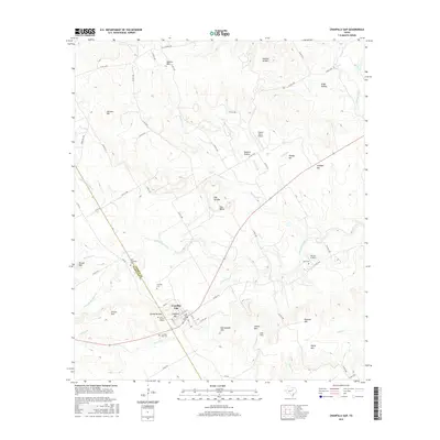
2016 Map of Cranfills Gap
USGS Topo · Published 2016About this map
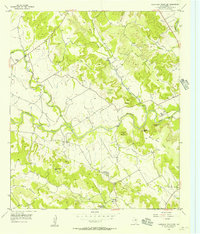
Cranfills Gap serves as the focal point of this Central Texas landscape, situated at the junction of FM 219 and several local routes along the Hamilton and Bosque county line. The settlement is surrounded by a cluster of cemeteries that offer significant value for genealogical research, including the Kidd Thompson Cem, Cranfills Cem, and the uniquely named Cox-Burton Graves. The terrain is defined by a series of prominent rises and drainage systems, with Cranfills Mtn and Rattlesnake Mtn overlooking the Goar Valley. Numerous seasonal and perennial watercourses, such as Meridian Creek and Mustang Cr, carve through the hills. Private aviation is present at the Francis Ranch Airport and Parrish Airstrip, while the rural character is maintained through a network of county roads serving isolated homesteads and ranch lands.
Find a feature on this map
64 named features on this map. Tap any name to fly to it.
Don’t see what you’re looking for? This feature index may not catch every label — zoom into the map to look around manually.
Map Details
Editions of this 2016 Cranfills Gap Map
This is the sole edition of this map. No revisions or reprints were ever made.
Other maps of this area

1888 · Meridian
USGS Topo · 1:125,000

1894 · Meridian
USGS Topo · 1:125,000

1954 · Waco
USGS Topo · 1:250,000

1955 · Waco
USGS Topo · 1:250,000

1955 · Meridian
USGS Topo · 1:24,000
1956 · Hurst Spring
USGS Topo · 1:24,000

1956 · Cranfills Gap
USGS Topo · 1:24,000
1956 · German Valley
USGS Topo · 1:24,000
1956 · Fairy
USGS Topo · 1:24,000
1956 · Sugarloaf Mountain
USGS Topo · 1:24,000