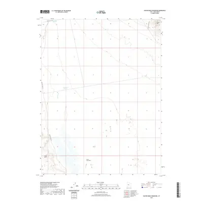
2020 Map of Crater Bench Reservoir
USGS Topo · Published 2020About this map
Arid basin landscapes in Juab County define this region, where the ancient path of the Old River Bed winds through the desert floor. This 2020 survey illustrates a complex hydrologic history, featuring the Crater Bench Reservoir and River Bed Reservoir nestled within the flat terrain. The presence of the Old River Bed suggests a former waterway that once flowed through this now-dry corridor, a significant landmark for those studying the prehistoric geography of the Great Basin. To the northeast, the elevation rises sharply toward Desert Mtn, while the southwestern corner is marked by the eponymous Crater Bench. Transport across this remote territory relies on established routes like Jericho Callao Rd and Baker Hot Springs Rd, which skirt the edges of the Cherry Creek Wash and provide access to this isolated part of the Utah desert.
Find a feature on this map
9 named features on this map. Tap any name to fly to it.
Don’t see what you’re looking for? This feature index may not catch every label — zoom into the map to look around manually.
Map Details
Editions of this 2020 Crater Bench Reservoir Map
This is the sole edition of this map. No revisions or reprints were ever made.
Other maps of this area

1885 · Sevier Desert
USGS Topo · 1:250,000

1953 · Delta
USGS Topo · 1:250,000

1958 · Delta
USGS Topo · 1:250,000

1962 · Delta
USGS Topo · 1:250,000

1971 · Baker Hot Springs
USGS Topo · 1:24,000

1971 · Rain Lake
USGS Topo · 1:24,000

1971 · Desert Mtn Pass
USGS Topo · 1:24,000

1971 · Crater Bench Reservoir
USGS Topo · 1:24,000
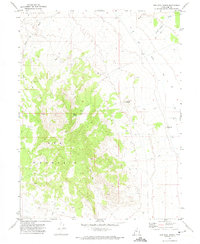
1971 · Keg Mtn Ranch
USGS Topo · 1:24,000

1971 · Fumarole Butte
USGS Topo · 1:24,000