
1971 Map of Desert Mtn Pass
USGS Topo · Published 1974About this map
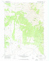
Desert Mountain dominates the southwestern portion of this Utah landscape, where a network of primitive transportation routes defines the arid terrain. Surveyed in the early 1970s, the map reveals a land utilized for localized mining and ranching operations, marked by several Prospect sites and a series of Borrow Pit excavations. Water management is critical in this environment, evidenced by the Coyote Knoll Reservoir and the Cow Hollow Well, which provide vital points of reference along the dry washes. Drainage patterns such as South Pine Wash and Erickson Wash carve through the basin floor between the prominent rises of the Allison Knolls and the central Desert Mtn Pass. The prevalence of a Jeep Trail network throughout the quadrangle underscores the isolation of this sector of Juab County during this era.
Find a feature on this map
12 named features on this map. Tap any name to fly to it.
Don’t see what you’re looking for? This feature index may not catch every label — zoom into the map to look around manually.
Map Details
Editions of this 1971 Desert Mtn Pass Map
This is the sole edition of this map. No revisions or reprints were ever made.
Other maps of this area

1885 · Sevier Desert
USGS Topo · 1:250,000

1953 · Delta
USGS Topo · 1:250,000

1955 · Indian Springs
USGS Topo · 1:24,000

1958 · Delta
USGS Topo · 1:250,000

1962 · Delta
USGS Topo · 1:250,000

1962 · Lynndyl
USGS Topo · 1:62,500

1963 · Dutch Peak
USGS Topo · 1:24,000

1963 · Cherry Creek
USGS Topo · 1:24,000
1971 · Erickson Knoll
USGS Topo · 1:24,000

1971 · Crater Bench Reservoir
USGS Topo · 1:24,000