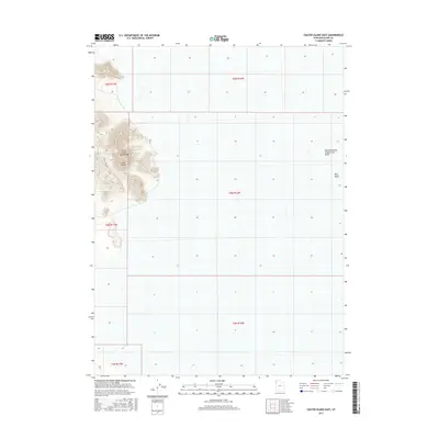
2017 Map of Crater Island East
USGS Topo · Published 2017About this map
The Silver Island Mountains dominate the western edge of this landscape, where the distinct landform of Crater Island rises above the surrounding flats. This 2017 survey reveals a stark, hydrologically unique environment on the edge of the Great Salt Lake desert, defined by the extensive Newfoundland Evaporation Basin to the east. The terrain is marked by the drainage patterns of Miry Wash, while the lone thoroughfare, Crater Island Rd, provides the primary access route through this desolate region. The map captures the interface between these mountainous outcrops and the vast, flat basins that characterize this portion of Tooele County.
Find a feature on this map
11 named features on this map. Tap any name to fly to it.
Don’t see what you’re looking for? This feature index may not catch every label — zoom into the map to look around manually.
Map Details
Editions of this 2017 Crater Island East Map
This is the sole edition of this map. No revisions or reprints were ever made.
Other maps of this area

1953 · Tooele
USGS Topo · 1:250,000

1954 · Brigham City
USGS Topo · 1:250,000

1955 · Tooele
USGS Topo · 1:250,000

1958 · Brigham City
USGS Topo · 1:250,000

1962 · Brigham City
USGS Topo · 1:250,000

1967 · Lemay Island
USGS Topo · 1:24,000

1970 · Crater Island
USGS Topo · 1:24,000

1971 · Graham Peak
USGS Topo · 1:24,000

1973 · Floating Island NE
USGS Topo · 1:24,000
1973 · Floating Island
USGS Topo · 1:24,000