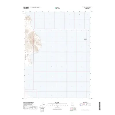
2023 Map of Crater Island East
USGS Topo · Published 2023About this map
The eastern edges of the Silver Island Mountains dominate the western portion of this Great Salt Lake Desert landscape, rising sharply from the surrounding salt flats. This environment is defined by extreme topography and hydraulic features, most notably the Newfoundland Evaporation Basin which occupies a significant portion of the eastern desert floor. The island-like character of the terrain is captured in the eponymous Crater Island, a prominent landform separated from the main mountain range. Transportation through this arid expanse is limited to Crater Island Rd, which skirts the base of the mountains. Natural drainage patterns are represented by Miry Wash, reflecting the ephemeral water systems that characterize this part of Box Elder County.
Find a feature on this map
5 named features on this map. Tap any name to fly to it.
Don’t see what you’re looking for? This feature index may not catch every label — zoom into the map to look around manually.
Map Details
Editions of this 2023 Crater Island East Map
This is the sole edition of this map. No revisions or reprints were ever made.
Other maps of this area

1953 · Tooele
USGS Topo · 1:250,000

1954 · Brigham City
USGS Topo · 1:250,000

1955 · Tooele
USGS Topo · 1:250,000

1958 · Brigham City
USGS Topo · 1:250,000

1962 · Brigham City
USGS Topo · 1:250,000

1967 · Lemay Island
USGS Topo · 1:24,000

1970 · Crater Island
USGS Topo · 1:24,000

1971 · Graham Peak
USGS Topo · 1:24,000

1973 · Floating Island NE
USGS Topo · 1:24,000
1973 · Floating Island
USGS Topo · 1:24,000