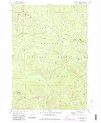
1972 Map of Crawfish Lake
USGS Topo · Published 1984About this map
Whitman National Forest land defines this portion of the Blue Mountains, where the boundary between Union and Grant counties cuts through high-elevation terrain. This 1972 survey, updated with 1984 revisions, captures a landscape shaped by early mining activity and remote wilderness access. At the southern edge of the map, a cluster of lode claims and workings including the Continental Mine, Standard Mine, and Labellevue Mine sit near the small settlement of Cabell City. The presence of a cemetery and Ruins near these sites points to the early 20th-century gold and silver prospecting that once thrived in these canyons.
Find a feature on this map
41 named features on this map. Tap any name to fly to it.
Don’t see what you’re looking for? This feature index may not catch every label — zoom into the map to look around manually.
Map Details
Editions of this 1972 Crawfish Lake Map
2 editions found
Other maps of this area

1901 · Sumpter
USGS Topo · 1:125,000

1953 · Pendleton
USGS Topo · 1:250,000

1955 · Canyon City
USGS Topo · 1:250,000

1956 · Pendleton
USGS Topo · 1:250,000

1959 · Canyon City
USGS Topo · 1:250,000

1965 · Limber Jim Creek
USGS Topo · 1:24,000

1965 · Anthony Butte
USGS Topo · 1:24,000

1965 · Fly Valley
USGS Topo · 1:24,000

1972 · Trout Meadows
USGS Topo · 1:24,000

1972 · Mt. Ireland
USGS Topo · 1:24,000