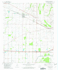
1981 Map of Crawfordsville
USGS Topo · Published 1982About this map
Crawfordsville serves as the primary hub of this eastern Arkansas landscape, where the Missouri Pacific railroad cuts a diagonal line through the Delta’s alluvial plains. The map reflects a deeply rooted community of small settlements and religious centers, including Vincent, Julius, and Ebony. Numerous country churches such as St Johns Ch, Ebenezer Ch, and Jackson Chapel are scattered across the terrain, often adjacent to family or community burial grounds like Bethel Cem and Mays Cem.
Find a feature on this map
35 named features on this map. Tap any name to fly to it.
Don’t see what you’re looking for? This feature index may not catch every label — zoom into the map to look around manually.
Map Details
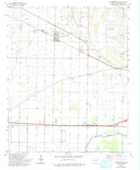
Editions of this 1981 Crawfordsville Map
2 editions found
Other maps of this area

1916 · Memphis
USGS Topo · 1:62,500

1925 · Memphis
USGS Topo · 1:48,000

1927 · Memphis
USGS Topo · 1:62,500

1931 · Jericho
USGS Topo · 1:62,500

1939 · Jericho
USGS Topo · 1:62,500

1939 · Edmondson
USGS Topo · 1:62,500

1939 · Memphis
USGS Topo · 1:62,500

1940 · Deckerville
USGS Topo · 1:62,500

1952 · Jericho
USGS Topo · 1:62,500

1953 · Memphis
USGS Topo · 1:250,000