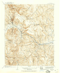
1914 Map of Creede
USGS Topo · Published 1959About this map
Mining operations and high mountain settlements dominate this 1914 survey of the San Juan Mountains, centered on the silver boom legacies of Creede and its surrounding camps. Industrial development is evident in the cluster of names near the Continental Divide, including Bachelor, North Creede, and the Nelson Tunnel. The geography reflects a landscape in transition, where mining sites like the Emma Mine sit near early recreation and conservation landmarks such as the Wheeler National Monument.
Find a feature on this map
135 named features on this map. Tap any name to fly to it.
Don’t see what you’re looking for? This feature index may not catch every label — zoom into the map to look around manually.
Map Details
Editions of this 1914 Creede Map
3 editions found
Other maps of this area

1905 · San Cristobal
USGS Topo · 1:125,000

1907 · San Cristobal
USGS Topo · 1:125,000

1908 · Uncompahgre
USGS Topo · 1:125,000

1911 · Uncompahgre
USGS Topo · 1:125,000

1913 · Summitville
USGS Topo · 1:125,000

1914 · Creede
USGS Topo · 1:125,000

1915 · Summitville
USGS Topo · 1:125,000

1915 · Del Norte
USGS Topo · 1:125,000

1916 · Creede
USGS Topo · 1:125,000

1917 · Del Norte
USGS Topo · 1:125,000