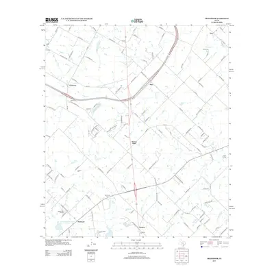
2013 Map of Creedmoor
USGS Topo · Published 2013About this map
Creedmoor and Mustang Ridge anchor this landscape south of Austin, where the Central Texas prairie is defined by a network of ephemeral creeks and established family burial grounds. The map reveals a pattern of rural clusters and crossroads communities, such as Carl, Maha, and Niederwald, many of which maintain their own community cemeteries including Carl Cem and Niederwald Cem. Water management is a visible priority in this terrain, evidenced by the Soil Conservation Service Site 16 Reservoir and the winding courses of Maha Cr and Cowpen Cr. This 2013 survey serves as a precise record of the regional transition between agriculture and suburban growth, capturing the intersection of major county routes like FM 1327 and local landmarks like the Jim Roach Field Airport.
Find a feature on this map
121 named features on this map. Tap any name to fly to it.
Don’t see what you’re looking for? This feature index may not catch every label — zoom into the map to look around manually.
Map Details
Editions of this 2013 Creedmoor Map
This is the sole edition of this map. No revisions or reprints were ever made.
Other maps of this area

1896 · Austin
USGS Topo · 1:125,000

1897 · Austin
USGS Topo · 1:125,000

1910 · Austin
USGS Topo · 1:125,000

1911 · San Marcos
USGS Topo · 1:125,000

1919 · San Marcos
USGS Topo · 1:125,000

1930 · Lockhart
USGS Topo · 1:62,500

1953 · Seguin
USGS Topo · 1:250,000

1954 · Austin
USGS Topo · 1:250,000

1955 · Montopolis
USGS Topo · 1:24,000

1955 · Oak Hill
USGS Topo · 1:24,000