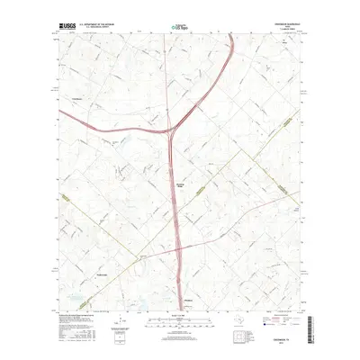
2016 Map of Creedmoor
USGS Topo · Published 2016About this map
Creedmoor and Mustang Ridge anchor this central Texas landscape, which sits at the intersection of Travis, Hays, Caldwell, and Bastrop counties. The map illustrates a transitional rural-suburban character defined by established small settlements like Niederwald and Mendoza alongside growing transportation corridors. Waterways such as Maha Cr, Cowpen Cr, and Cedar Cr drain the terrain, providing natural landmarks for local history and genealogy. Numerous family and community burial grounds, including Carl Cem, Nelson Cem, and Vasquez Cem, are scattered across the quadrangle, serving as vital points of interest for researchers tracing ancestral roots in the region. The presence of the Soil Conservation Service Site 16 Reservoir and Clark Lake highlights regional water management efforts in this part of the state, while the network of state and local roads, such as FM 1327, connects these historically distinct communities as they adapt to modern development patterns.
Find a feature on this map
116 named features on this map. Tap any name to fly to it.
Don’t see what you’re looking for? This feature index may not catch every label — zoom into the map to look around manually.
Map Details
Editions of this 2016 Creedmoor Map
This is the sole edition of this map. No revisions or reprints were ever made.
Other maps of this area

1896 · Austin
USGS Topo · 1:125,000

1897 · Austin
USGS Topo · 1:125,000

1910 · Austin
USGS Topo · 1:125,000

1911 · San Marcos
USGS Topo · 1:125,000

1919 · San Marcos
USGS Topo · 1:125,000

1930 · Lockhart
USGS Topo · 1:62,500

1953 · Seguin
USGS Topo · 1:250,000

1954 · Austin
USGS Topo · 1:250,000

1955 · Montopolis
USGS Topo · 1:24,000

1955 · Oak Hill
USGS Topo · 1:24,000