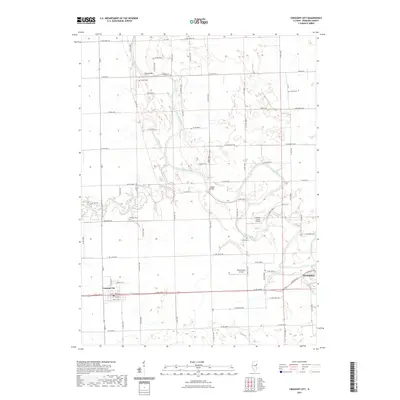
2021 Map of Crescent City
USGS Topo · Published 2021About this map
The Iroquois River meanders through this portion of Iroquois County, defining a landscape of agricultural tradition and riverine geometry. To the west, the village of Crescent City sits along the southern rail corridor, while the western edge of Watseka occupies the eastern margin where Sugar Creek joins the larger river system. The map reveals a network of rural connections anchored by family-named landmarks and infrastructure, such as Plato Bridge and Fiddler Bridge, which serve as vital crossing points for the surrounding farm-to-market road grid.
Find a feature on this map
57 named features on this map. Tap any name to fly to it.
Don’t see what you’re looking for? This feature index may not catch every label — zoom into the map to look around manually.
Map Details
Editions of this 2021 Crescent City Map
This is the sole edition of this map. No revisions or reprints were ever made.
Other maps of this area

1935 · Watseka
USGS Topo · 1:48,000

1938 · Milford
USGS Topo · 1:48,000

1939 · Watseka
USGS Topo · 1:62,500

1939 · Cissna Park
USGS Topo · 1:62,500

1944 · Milford
USGS Topo · 1:62,500

1944 · Gilman
USGS Topo · 1:62,500

1946 · Gilman
USGS Topo · 1:62,500

1949 · Cissna Park
USGS Topo · 1:62,500

1953 · Danville
USGS Topo · 1:250,000

1955 · Danville
USGS Topo · 1:250,000