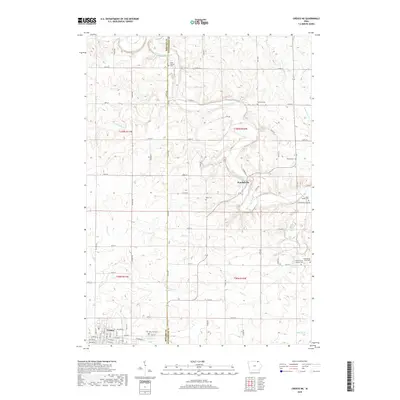
2018 Map of Cresco NE
USGS Topo · Published 2018About this map
Upper Iowa River meanders across the northern portion of this landscape, carving a valley through the agricultural terrain on the Howard County and Winneshiek County border. The map illustrates a rural settlement pattern defined by isolated farmsteads and numerous small burial grounds, often associated with early immigrant families and local parishes. In the north, Saint Kierans Cem and Fremont Cem overlook the river valley, while further south, the First Orleans Lutheran Cem and the unique Ferkindstad Farm Cem reflect the deep genealogical roots of the area. The small community of Kendallville sits at a crossing of the river, while the northeastern corner of Cresco is visible at the southern edge, where the grid shifts toward the larger settlement. The drainage network is dense with tributaries like Bigalks Cr, Minor Cr, and Silver Cr, highlighting the importance of water access in this productive corner of Iowa.
Find a feature on this map
53 named features on this map. Tap any name to fly to it.
Don’t see what you’re looking for? This feature index may not catch every label — zoom into the map to look around manually.
Map Details
Editions of this 2018 Cresco NE Map
This is the sole edition of this map. No revisions or reprints were ever made.
Other maps of this area

1906 · Decorah
USGS Topo · 1:125,000

1954 · Mason City
USGS Topo · 1:250,000

1957 · Mason City
USGS Topo · 1:250,000

1958 · Mason City
USGS Topo · 1:250,000

1958 · La Crosse
USGS Topo · 1:250,000

1961 · La Crosse
USGS Topo · 1:250,000

1965 · La Crosse
USGS Topo · 1:250,000

1965 · Greenleafton
USGS Topo · 1:24,000

1965 · Harmony
USGS Topo · 1:24,000

1965 · Canton
USGS Topo · 1:24,000