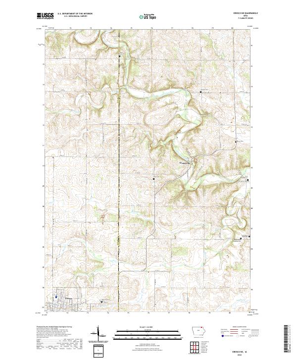
2022 Map of Cresco NE
USGS Topo · Published 2022About this map
The Upper Iowa River cuts a winding path through the northern half of this Winneshiek County landscape, defining the local topography near the settlement of Kendallville. This 2022 survey provides a detailed look at the rural transition between Howard and Winneshiek counties, where a dense network of secondary roads such as Yankee Ave and 345th Ave connects established agricultural lands and several small cemeteries. For family historians, the map is particularly valuable for its documentation of local burial sites, including Saint Kierans Cem, Fremont Cem, and the uniquely named Ferkindstad Farm Cem. In the southwest corner, the northern edge of Cresco is visible, showing the residential grid near Oak Lawn Cem and Mullens Cr. The map captures the quiet, dispersed nature of these Iowa townships, where geographic features like Black Falls and Minor Cr punctuate the vast stretches of farmland.
Find a feature on this map
57 named features on this map. Tap any name to fly to it.
Don’t see what you’re looking for? This feature index may not catch every label — zoom into the map to look around manually.
Map Details
Editions of this 2022 Cresco NE Map
This is the sole edition of this map. No revisions or reprints were ever made.
Other maps of this area

1906 · Decorah
USGS Topo · 1:125,000

1954 · Mason City
USGS Topo · 1:250,000

1957 · Mason City
USGS Topo · 1:250,000

1958 · Mason City
USGS Topo · 1:250,000

1958 · La Crosse
USGS Topo · 1:250,000

1961 · La Crosse
USGS Topo · 1:250,000

1965 · La Crosse
USGS Topo · 1:250,000

1965 · Greenleafton
USGS Topo · 1:24,000

1965 · Harmony
USGS Topo · 1:24,000

1965 · Canton
USGS Topo · 1:24,000