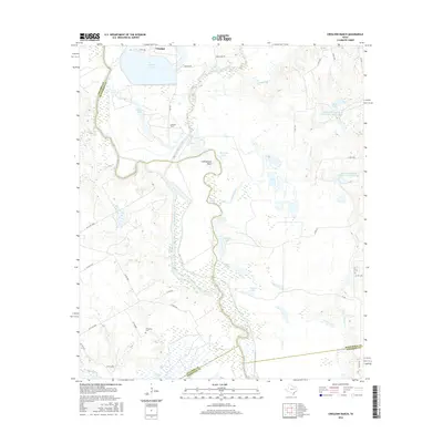
2016 Map of Creslenn Ranch
USGS Topo · Published 2016About this map
Trinidad and its namesake Trinidad Lake occupy the northern reaches of this East Texas terrain, where the Trinity River snakes southward through a complex network of oxbows and bottomland marshes. This riverine landscape is defined by its hydraulic history, with distinctive water bodies like The Cutoff and Cottonwood Bend indicating the river's shifting course over time. The map documents a significant intersection of county boundaries, where Henderson, Navarro, Freestone, and Anderson counties converge amidst a mosaic of private ranch lands and water conservation sites.
Find a feature on this map
49 named features on this map. Tap any name to fly to it.
Don’t see what you’re looking for? This feature index may not catch every label — zoom into the map to look around manually.
Map Details
Editions of this 2016 Creslenn Ranch Map
This is the sole edition of this map. No revisions or reprints were ever made.
Other maps of this area

1949 · Athens
USGS Topo · 1:62,500

1949 · Tennessee Colony
USGS Topo · 1:62,500

1950 · Athens
USGS Topo · 1:62,500

1950 · Tennessee Colony
USGS Topo · 1:62,500

1953 · Palestine
USGS Topo · 1:250,000

1954 · Dallas
USGS Topo · 1:250,000

1954 · Waco
USGS Topo · 1:250,000

1955 · Waco
USGS Topo · 1:250,000

1956 · Tyler
USGS Topo · 1:250,000

1957 · Palestine
USGS Topo · 1:250,000