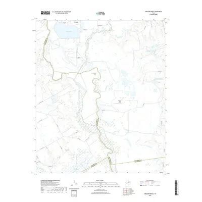
2019 Map of Creslenn Ranch
USGS Topo · Published 2019About this map
Trinidad sits at the northern edge of a landscape defined by the shifting course of the Trinity River and the complex hydrography of its surrounding bottomlands. The river's historical movement is visible through features like Cottonwood Bend and The Cutoff, while numerous oxbows and reservoirs, including Trinidad Lake, Stephens Lake, and Carroll Lake, dominate the terrain. This 2019 survey documents the intersection of several Texas counties—Henderson, Navarro, Freestone, and Anderson—where the river serves as a primary boundary. Large-scale rural holdings like the namesake Creslenn Ranch and the Sanctuary Ranch Airport occupy the higher ground between the river and its tributaries, such as Cedar Creek and Turkey Creek. For local historians and genealogists, the inclusion of Princeton Cem provides a specific point of reference in the rural landscape south of the town, amidst a network of county roads that navigate the marshes and creeks of the river valley.
Find a feature on this map
47 named features on this map. Tap any name to fly to it.
Don’t see what you’re looking for? This feature index may not catch every label — zoom into the map to look around manually.
Map Details
Editions of this 2019 Creslenn Ranch Map
This is the sole edition of this map. No revisions or reprints were ever made.
Other maps of this area

1949 · Athens
USGS Topo · 1:62,500

1949 · Tennessee Colony
USGS Topo · 1:62,500

1950 · Athens
USGS Topo · 1:62,500

1950 · Tennessee Colony
USGS Topo · 1:62,500

1953 · Palestine
USGS Topo · 1:250,000

1954 · Dallas
USGS Topo · 1:250,000

1954 · Waco
USGS Topo · 1:250,000

1955 · Waco
USGS Topo · 1:250,000

1956 · Tyler
USGS Topo · 1:250,000

1957 · Palestine
USGS Topo · 1:250,000