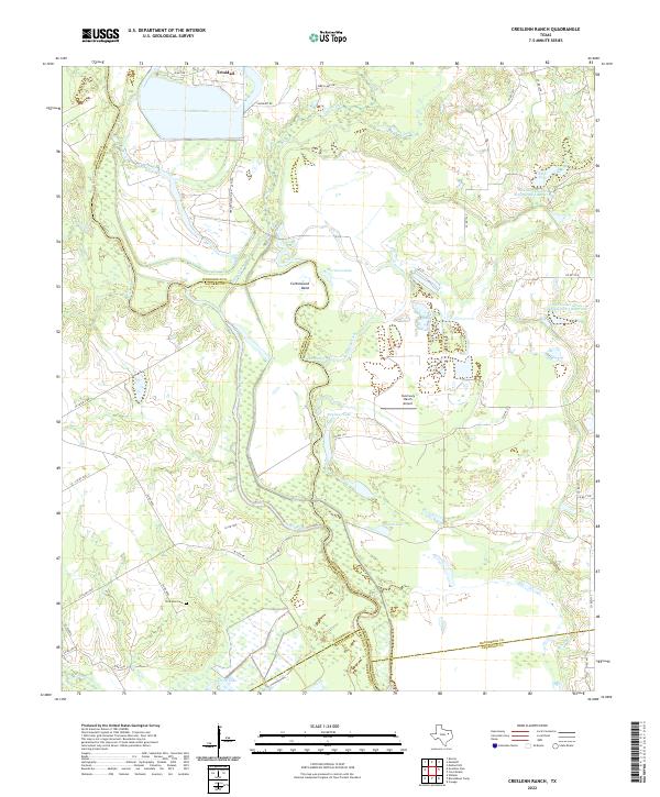
2022 Map of Creslenn Ranch
USGS Topo · Published 2022About this map
Trinidad sits at the northern edge of this landscape, overlooking Trinidad Lake and the complex riverine system that marks the confluence of Cedar Creek and the Trinity River. This territory is defined by the winding border between Henderson, Navarro, and Freestone counties, following the erratic path of the river through numerous oxbows and backwaters like Cottonwood Bend and The Cutoff. The terrain is dominated by low-lying wetlands and various reservoirs, including the Soil Conservation Service Site 3 Reservoir and Hall Lake, reflecting the intensive water management required in this reach of the Trinity basin.
Find a feature on this map
48 named features on this map. Tap any name to fly to it.
Don’t see what you’re looking for? This feature index may not catch every label — zoom into the map to look around manually.
Map Details
Editions of this 2022 Creslenn Ranch Map
This is the sole edition of this map. No revisions or reprints were ever made.
Other maps of this area

1949 · Athens
USGS Topo · 1:62,500

1949 · Tennessee Colony
USGS Topo · 1:62,500

1950 · Athens
USGS Topo · 1:62,500

1950 · Tennessee Colony
USGS Topo · 1:62,500

1953 · Palestine
USGS Topo · 1:250,000

1954 · Dallas
USGS Topo · 1:250,000

1954 · Waco
USGS Topo · 1:250,000

1955 · Waco
USGS Topo · 1:250,000

1956 · Tyler
USGS Topo · 1:250,000

1957 · Palestine
USGS Topo · 1:250,000