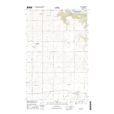
2017 Map of Creston
USGS Topo · Published 2017About this map
Creston anchors the southern portion of this Lincoln County landscape, situated where the high plateau begins its descent toward the Columbia River basin. To the north, the terrain is defined by the expansive Lake Roosevelt National Recreation Area, where the waters of Franklin D Roosevelt Lake reach into Moonshine Bay. This geography creates a sharp contrast between the organized grid of agricultural roads like Lartzen Rd and the complex drainage systems of Sherman Cr and Goose Cr. Further north, the settlement of Sherman sits amidst a network of canyons and draws, including Tamarack Canyon and Sage Hen Draw, illustrating the historical reliance on these natural corridors for movement through the broken coulee country of eastern Washington.
Find a feature on this map
52 named features on this map. Tap any name to fly to it.
Don’t see what you’re looking for? This feature index may not catch every label — zoom into the map to look around manually.
Map Details
Editions of this 2017 Creston Map
This is the sole edition of this map. No revisions or reprints were ever made.
Other maps of this area

1948 · Wilbur
USGS Topo · 1:62,500

1948 · Lincoln
USGS Topo · 1:62,500

1950 · Lincoln
USGS Topo · 1:62,500

1950 · Wilbur
USGS Topo · 1:62,500

1953 · Ritzville
USGS Topo · 1:250,000

1959 · Ritzville
USGS Topo · 1:250,000

1965 · Ritzville
USGS Topo · 1:250,000

1969 · Telford
USGS Topo · 1:24,000

1969 · Creston Butte
USGS Topo · 1:24,000

1969 · Wagner Lake
USGS Topo · 1:24,000