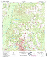
1973 Map of Crestview North
USGS Topo · Published 1987About this map
Crestview serves as the primary urban hub in this study of northern Okaloosa County, appearing at a time of established civic infrastructure including Northwood Sch, a Post Office, and City Hall. The landscape to the north and west is dominated by the dense woodlands of the Blackwater River State Forest and smaller sections of State Forest, where the Yellow River and its many tributaries like Murder Creek and Silver Creek carve through the terrain. Evidence of early industry and community life is scattered throughout the rural sections, from the Tidwell Mill site near Tucker Bluff to the historic Reeder Cemetery in Campton. The presence of Pipelines and the large Bob Sikes Airport east of the city center highlights the mid-century transition toward modern transportation and utility networks, even as small settlements like Garden City and Auburn maintain their distinct rural character.
Find a feature on this map
69 named features on this map. Tap any name to fly to it.
Don’t see what you’re looking for? This feature index may not catch every label — zoom into the map to look around manually.
Map Details
Editions of this 1973 Crestview North Map
3 editions found
Other maps of this area

1934 · Holt
USGS Topo · 1:48,000

1934 · Niceville
USGS Topo · 1:48,000

1936 · Niceville
USGS Topo · 1:62,500

1937 · Holt
USGS Topo · 1:62,500

1949 · Crestview
USGS Topo · 1:62,500

1949 · Laurel Hill
USGS Topo · 1:62,500

1950 · Laurel Hill
USGS Topo · 1:62,500

1951 · Crestview
USGS Topo · 1:62,500

1956 · Niceville
USGS Topo · 1:62,500

1956 · Holt
USGS Topo · 1:62,500