Loading...
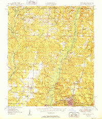
Loading map...1951 Map of Crestview
USGS Topo · Published 1951About this map
The Yellow River and Blackwater River systems define the geography of this northern Florida region, where the Louisville and Nashville Railroad serves as a vital corridor through Crestview and Milligan. This mid-century landscape is dotted with rural centers such as Baker, Blackman, and Escambia Farms, alongside numerous country churches including Old Bethel Ch and New Bethel Ch. The northern portion of the map shows the transition into Alabama, crossing into the Conecuh National Forest.
Find a feature on this map
109 named features on this map. Tap any name to fly to it.
Don’t see what you’re looking for? This feature index may not catch every label — zoom into the map to look around manually.
Map Details
Date Portrayed1951
Date Published1951
PublisherU.S. Geological Survey
Map TypeTopographic
Scale1:62,500
Physical Dimensions17.9 x 20.7 inches
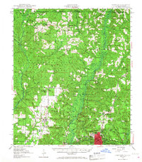
Editions of this 1951 Crestview Map
2 editions found
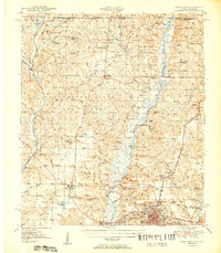
Historical Maps of Crestview Through Time
3 maps found

Featured Locations
Source Details
SourceU.S. Geological Survey
CopyrightPublic Domain