
Loading...
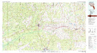
Loading map...1978 Map of Crestview
USGS Topo · Published 1982About this map
Crestview serves as a central hub on this mid-1970s survey, where the Louisville and Nashville Railroad cuts across the Panhandle. To the south, the massive footprint of Eglin Air Force Base dominates the landscape, including several numbered auxiliary fields and the coastal communities of Valparaiso and Niceville along Boggy Bayou. The northern reaches of the map transition into the Conecuh National Forest at the Alabama Florida state line, illustrating the dense woodlands and timber country that defined the region's early economy.
Find a feature on this map
110 named features on this map. Tap any name to fly to it.
Don’t see what you’re looking for? This feature index may not catch every label — zoom into the map to look around manually.
Map Details
Date Portrayed1978
Date Published1982
PublisherU.S. Geological Survey
Map TypeTopographic
Scale1:100,000
Physical Dimensions44 x 24 inches
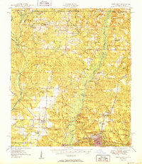
Editions of this 1978 Crestview Map
2 editions found
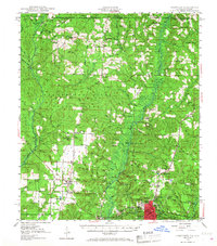
Historical Maps of Crestview Through Time
3 maps found
Featured Locations
Source Details
SourceU.S. Geological Survey
CopyrightPublic Domain