
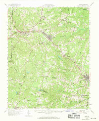
1958 Map of Crewe
USGS Topo · Published 1959About this map
Crewe serves as a central rail hub in the late 1950s, where the Norfolk and Western and Southern railroads intersect amidst a landscape of small Piedmont communities. The map highlights the town's industrial character with numerous rail sidings and a Radio Tower (WSVS), while nearby Burkeville and Blackstone anchor the eastern and western ends of this Nottoway County corridor. A network of rural schools and churches, such as Hickory Grove Sch and Wards Chapel, connects smaller settlements like Jennings Ordinary and Martins Corner.
Find a feature on this map
84 named features on this map. Tap any name to fly to it.
Don’t see what you’re looking for? This feature index may not catch every label — zoom into the map to look around manually.
Map Details
Editions of this 1958 Crewe Map
2 editions found
Other maps of this area

1891 · Farmville
USGS Topo · 1:125,000

1893 · Farmville
USGS Topo · 1:125,000

1897 · Amelia
USGS Topo · 1:125,000

1918 · Lawrenceville
USGS Topo · 1:62,500

1920 · Lawrenceville
USGS Topo · 1:48,000

1921 · Lawrenceville
USGS Topo · 1:62,500

1942 · Lawrenceville
USGS Topo · 1:62,500

1943 · Amelia
USGS Topo · 1:31,680

1943 · Richmond
USGS Topo · 1:250,000

1947 · Roanoke
USGS Topo · 1:250,000