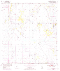
1953 Map of Crewsville SE
USGS Topo · Published 1973About this map
Oak Creek Marsh dominates the interior of this Florida landscape, where the shifting boundaries of Highlands, Hardee, and De Soto counties meet. This 1953 survey, updated with 1972 aerial photography, reveals a region defined by its water management and wilderness tracks. The presence of Spoil Bank and various Levee structures along the eastern edge indicates significant environmental modification, likely for drainage or agricultural purposes.
Find a feature on this map
11 named features on this map. Tap any name to fly to it.
Don’t see what you’re looking for? This feature index may not catch every label — zoom into the map to look around manually.
Map Details
Editions of this 1953 Crewsville SE Map
4 editions found
Other maps of this area

1952 · Sebring
USGS Topo · 1:24,000

1953 · Lake June In Winter
USGS Topo · 1:24,000

1953 · Venus NW
USGS Topo · 1:24,000

1953 · Crewsville SE
USGS Topo · 1:24,000

1953 · Crewsville
USGS Topo · 1:24,000

1956 · Sweetwater
USGS Topo · 1:24,000

1956 · Crewsville SW
USGS Topo · 1:24,000

1956 · Fort Pierce
USGS Topo · 1:250,000

1957 · Long Island Marsh NW
USGS Topo · 1:24,000

1957 · Long Island Marsh NE
USGS Topo · 1:24,000