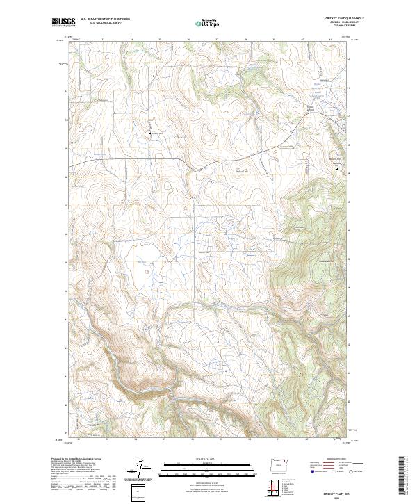
2023 Map of Cricket Flat
USGS Topo · Published 2023About this map
Cricket Flat and Elk Flat dominate this section of Union County, Oregon, revealing a landscape defined by elevated plateaus and the deep drainages of the Blue Mountain foothills. The area is marked by a sophisticated water management system for ranching or forestry, including Waller Reservoir 6, Waller Reservoir 4, and Roulet Pond. Genealogists will find historical markers such as Highland Cem near Good RD and the Pine Grove Cem located just south of Minam Hill.
Find a feature on this map
44 named features on this map. Tap any name to fly to it.
Don’t see what you’re looking for? This feature index may not catch every label — zoom into the map to look around manually.
Map Details
Editions of this 2023 Cricket Flat Map
This is the sole edition of this map. No revisions or reprints were ever made.
Other maps of this area

1906 · Telocaset
USGS Topo · 1:125,000

1955 · Grangeville
USGS Topo · 1:250,000

1959 · Grangeville
USGS Topo · 1:250,000

1964 · Partridge Creek
USGS Topo · 1:24,000

1964 · Howard Butte
USGS Topo · 1:24,000

1964 · Cricket Flat
USGS Topo · 1:24,000

1964 · Minam
USGS Topo · 1:24,000

1964 · Elgin
USGS Topo · 1:24,000

1964 · Rondowa
USGS Topo · 1:24,000
1965 · Gasset Bluff
USGS Topo · 1:24,000