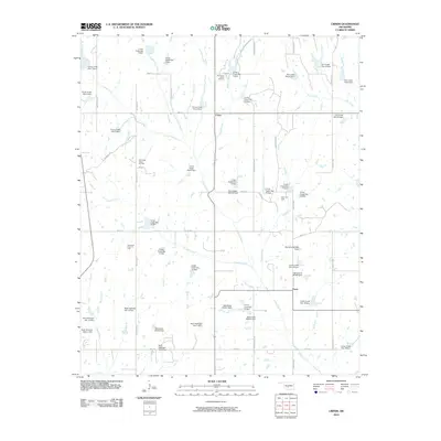
2010 Map of Criner
USGS Topo · Published 2010About this map
Criner and Payne anchor this agricultural and energy-producing landscape in McClain County during the early 21st century. The map reveals an extensive system of watershed management, defined by numerous dams and impoundments including Criner Creek Site 5 Dam and Finn Creek Site 22 Dam. This infrastructure supports the surrounding rural community where section-line roads like Meridian Ave and Western Ave create a rigid grid across the undulating terrain. Local economic activity is clearly marked by several petroleum extraction zones, such as the Northeast Criner Oil Field and the Southwest Criner Oil Field. These fields, alongside the Southeast Curty Oil Field and Payne Oil Field, illustrate the region's reliance on subterranean resources integrated within its ranching and farming footprint.
Find a feature on this map
65 named features on this map. Tap any name to fly to it.
Don’t see what you’re looking for? This feature index may not catch every label — zoom into the map to look around manually.
Map Details
Editions of this 2010 Criner Map
This is the sole edition of this map. No revisions or reprints were ever made.
Other maps of this area

1893 · Norman
USGS Topo · 1:62,500

1898 · Purcell
USGS Topo · 1:125,000

1898 · Pauls Valley
USGS Topo · 1:125,000

1902 · Pauls Valley
USGS Topo · 1:125,000

1902 · Rush Springs
USGS Topo · 1:125,000

1904 · Chickasha
USGS Topo · 1:125,000

1936 · Norman
USGS Topo · 1:62,500

1954 · Oklahoma City
USGS Topo · 1:250,000

1957 · Ardmore
USGS Topo · 1:250,000

1957 · Oklahoma City
USGS Topo · 1:250,000