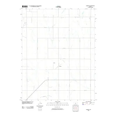
2009 Map of Crisfield
USGS Topo · Published 2009About this map
Crisfield and its surroundings in Harper County represent a quintessentially quiet agricultural landscape defined by a grid of rural section roads and winding watercourses. The local geography is etched by the paths of Little Sandy Creek, Sandy Creek, and West Sandy Creek, which draw through the plains alongside other tributaries like Bachelor Creek and Cottonwood Creek. Central to the community's history and genealogy is the Crisfield Cemetery, located just north of the primary settlement cluster near the intersection of NW 160 Ave and NW 20 Rd. This survey documents a traditional Kansas farming area where the infrastructure is almost entirely dedicated to land access, featuring named thoroughfares such as Harper Rd and Catalpa Rd. The distribution of farmsteads and the preservation of the local cemetery provide a clear record of the area's rural development and residency patterns into the 21st century.
Find a feature on this map
26 named features on this map. Tap any name to fly to it.
Don’t see what you’re looking for? This feature index may not catch every label — zoom into the map to look around manually.
Map Details
Editions of this 2009 Crisfield Map
This is the sole edition of this map. No revisions or reprints were ever made.
Other maps of this area

1889 · Anthony
USGS Topo · 1:125,000

1891 · Anthony
USGS Topo · 1:125,000

1955 · Pratt
USGS Topo · 1:250,000

1959 · Pratt
USGS Topo · 1:250,000

1972 · Attica
USGS Topo · 1:24,000

1972 · Sharon South
USGS Topo · 1:24,000
1972 · Kiowa
USGS Topo · 1:24,000
1972 · Waldron
USGS Topo · 1:24,000
1972 · Corwin
USGS Topo · 1:24,000

1972 · Crisfield
USGS Topo · 1:24,000