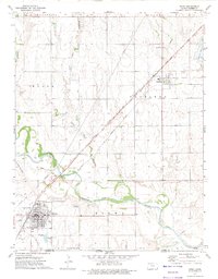
1972 Map of Kiowa
USGS Topo · Published 1975About this map
The Medicine Lodge River carves through the southern Kansas landscape, where the Old Indian Treaty Boundary marks a historical demarcation line across the plains. This 1972 survey reveals a transportation hub at the state line, where the Atchison Topeka and Santa Fe and Missouri Pacific railroads converge near the town of Hazelton. The intricate drainage patterns of Lone Tree Canyon and smaller tributaries contrast with the established grid of agricultural sections and township boundaries.
Find a feature on this map
24 named features on this map. Tap any name to fly to it.
Don’t see what you’re looking for? This feature index may not catch every label — zoom into the map to look around manually.
Map Details
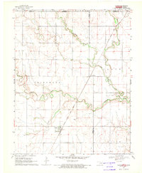
Editions of this 1972 Kiowa Map
This is the sole edition of this map. No revisions or reprints were ever made.
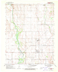
Other maps of this area

1889 · Anthony
USGS Topo · 1:125,000

1891 · Medicine Lodge
USGS Topo · 1:125,000

1891 · Anthony
USGS Topo · 1:125,000

1893 · Medicine Lodge
USGS Topo · 1:125,000

1955 · Woodward
USGS Topo · 1:250,000

1955 · Pratt
USGS Topo · 1:250,000

1958 · Woodward
USGS Topo · 1:250,000

1959 · Pratt
USGS Topo · 1:250,000
1968 · Capron
USGS Topo · 1:24,000
1969 · Amorita
USGS Topo · 1:24,000