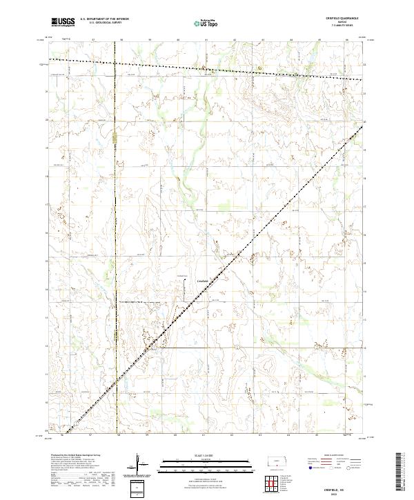
2022 Map of Crisfield
USGS Topo · Published 2022About this map
The small community of Crisfield sits at the heart of this rural landscape, positioned along the border where Barber and Harper counties meet. The area is defined by a dense network of watercourses, including the meandering paths of Cottonwood Creek, Spring Creek, and Little Sandy Creek. These streams cut through the grid of country roads, where local history is anchored by the Crisfield Cemetery and legacy routes like Pleasant Hill Road and College Hill.
Find a feature on this map
29 named features on this map. Tap any name to fly to it.
Don’t see what you’re looking for? This feature index may not catch every label — zoom into the map to look around manually.
Map Details
Editions of this 2022 Crisfield Map
This is the sole edition of this map. No revisions or reprints were ever made.
Other maps of this area

1889 · Anthony
USGS Topo · 1:125,000

1891 · Anthony
USGS Topo · 1:125,000

1955 · Pratt
USGS Topo · 1:250,000

1959 · Pratt
USGS Topo · 1:250,000

1972 · Attica
USGS Topo · 1:24,000

1972 · Sharon South
USGS Topo · 1:24,000
1972 · Kiowa
USGS Topo · 1:24,000
1972 · Waldron
USGS Topo · 1:24,000
1972 · Corwin
USGS Topo · 1:24,000

1972 · Crisfield
USGS Topo · 1:24,000